Posts

Showing posts from 2010

One Tagaytay Place

Image
One Tagaytay Place may not be known to many, since the Genesis-managed hotel is located at the other ned of Aguinaldo Highway, on the way to Highlands. And there's really no clear signboard. So when we were looking for the hotel, we were keeping our eyes open.

Heaven Found in Thunderbird Poro Point

Image
From the South, all the way up North. Friends, let me take you to another spontaneous trip up the famous coasts of La Union, to a place that I called heaven for 2 days. That heaven is called Thunderbird Resort in Poro Point.

A Quick Trip to Saranggani

Image
I'm a crazy traveler, and I think I have inspired others to follow my craziness. Hence, one day, when we were in Davao, our group decided to just head off spontaenously to Saranggani province, which is just 3 hours away. Well, think it's just Batangas if you're living in Davao, so it's not that bad.

Maxima by the Sea: Pure Bliss in Samal

Image
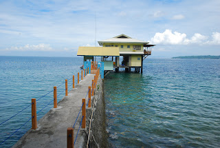
I have been open about my love relationship with Samal, and again, she impressed me with this place. Around 30 minutes drive from the roro port of Samal from Davao City, we arrived at a dark night at Maxima by the Sea, a house that literally is built on water.

Another Pitfall on the Road to Tourism Greatness

Image
I began exploring the Philippines and sharing my experiences because I felt that the government is not actively promoting our beautiful country as it should be. I felt the need to contribute, hence The Island Explorer was born. I tried to pick up some of my past travels around the country and show everyone how much can be seen. And I am just focusing on islands, beaches and natural wonders. I'm not even touching much on festivals, cultural monuments and the like. I featured restaurants, resorts, hotels, tours and destinations that are deserving attention. I expanded my blog to featuring my travels in South East Asia, which is more of a frustrating release after seeing how the tourism industries in our neighbors are flourishing. I remember hiking in China, and being asked by a group of European backpackers who were traveling the world: Where is the Philippines? Imagine, they didn't even know where it was. Like we were out of the map. And we were, to most of these travelers, si...

Ending Happy with El Nido

Image
Our short vacation in El Nido was coming to an end, and believe me, those days were not even close to enough to truly enjoy and explore this beautiful place.

Exploring El Nido

Image
We woke up to a beautiful day in El Nido, with the sun now shining. The Miniloc Resort glittered with life as the morning's activities were beginning. It started with feeding the jacks found on the resort's house reef. The jack's were huge, probably averaging at almost 2 feet long. It was an experience to be swimming with them as well. The feeding of the jacks happen only here in Miniloc, thus, making the resort again a better place for kids.

Miniloc Island Resort: El Nido, Palawan Series

Image
Finally, I am on a journey to one of the most desired tourist hotspots in the country. And it begins in this small plane, similar to the plane I took to Sulu and Tawi-Tawi, only more luxurious. I was so anxious to land safe and sound in the northern part of Palawan, in a place called El Nido.

UP NEXT: Guess where?

Image
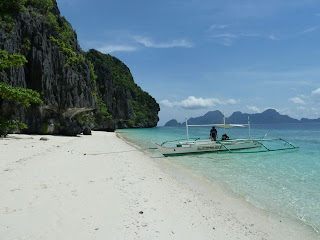
It is one of the most desired tourist hotspots in the country, and I can't believe I had just visited this place this year. The limestone formations are a giveaway. Stay tuned!

Smallville: Iloilo City

Image
Since we're in Iloilo already, I just want to take you guys to the best nightspot in this part of the country. Welcome to Smallville.

Agho Island: Concepcion, Iloilo

Image
After working in Malangabang Island, we just had to pass by one of the alluring islands of Concepcion. The nearest to our route was this island.

Malangabang Island: Concepcion, Iloilo

Image
I've always wanted to visit the islands of Concepcion in Iloilo, but never found an opportunity to go there. So, I was pleasantly surprised that one of my shoots was located there - and on an island. Concepcion is in the Northern part of Iloilo, around 2 hours away. It is found before Miagao, so if you're headed to the Miagao Church, better pass by this group of islands.

Kenyama Resort, Guimras

Image
I guess you all know by now that most of my travels are actually side trips from work. I extend my stay for a couple of days, especially on weekends. As a result, I get to explore a lot of places. One of my most recent extended stays was in Guimaras, one of my favorite islands in the Philippines.

Balaw Balaw: Folk Food, Folk Art

Image
Around 30 minutes away from Ortigas without traffic is one of the most talked about restaurants in the country. It is located in the art capital of the country as well, in the town of Angono in Rizal. 

A Day Across Bukidnon

Image
We had to conitnue on with work the next day, this time to the neighboring province of Bukidnon. I have never explored Bukidnon, and my friend tells me there's really nothing much to do there. On the way, I was amazed at the breathtaking landscapes of green fields amidst a mountainous backdrop. After almost 2 hours of travel, we arrived in the capital, Malaybalay.

The Divine Mercy Shrine: El Salvador, Misamis Oriental

Image
Going back from Iligan City, our driver suggested we visit a shrine that was nestled on top of a hill. The shrine was of the Divine Mercy. Being apathetic about shrines and temples that time, I didn't take interest. 

The Power of Maria Cristina Falls

Image
2 hour away from Cagayan de Oro is the progressive city of Iligan in Lanao del Norte. Now while some may reject the idea of going to Lanao all together, I was eager enough to discover what the province has to offer. And of course, there was one place that I had to go to, the grand Maria Cristina Falls.

UP NEXT: Guess where?

Image
Guess where this is. Our version of Brazil's Christ the Redeemer, up next!

Hotel St. Ellis, Legazpi City

Image
My very brief stay in Legazpi was made memorable because of the hotel I stayed in. When my tita who was managing the hotel told me to visit her, I didn't expect to see this. 

Revisiting Legazpi

Image
Legazpi City in Albay is familiar city to most Filipinos, because of Mt. Mayon. The last time I was in Legazpi, I was still a teenager. Now, probably after 15 years, I arrive at the hometown of my father, hoping to catch a glimpse of one of the most prominent cities of Bicol.

Phuket: The Ultimate Asian Beach Destination

Image
Let's get our of the country for a while, and visit one of the most desired Asian destinations. It is the largest island in Thailand, and an hour's plane ride south of Bangkok. Despite its reputation for being the most tourist infested beach capital of Asia, it still remains to be one elusive destination. Join me as we touch down in Phuket.

Callao Caves: Cagayan North Series

Image
I almost forgot this part of the trip. Well, it's not already part of Sta. Ana. After that memorable trip to Palaui and its surrounding islands, we headed back the next day, refreshed and recharged to Tuguegarao for our flight back to Manila. Most of us were able to visit the Callao Caves way back in 2008, but we decided to revisit the place, for the sake of those who haven't experienced it yet. Callao Caves is located around 30 minutes away from Tuguegarao, in the town of Penablanca. There is an entrance fee to the caves, and the last time we visited, there was this boy wonder of a tour guide, who followed us through the caves with stories and descriptions of the rock formations. We were looking for boy wonder, who spoke fluent English, but he wasn't available. You go up around 100 steps to reach the cave entrance. Then, in the second chamber, you will fall upon this magnificent chapel inside. You may have seen this photo in most magazines, but it's still diffe...

Crocodile Island: Cagayan North Series

Image
Crocodile Island was called as such because it did look like a crocodile with its head above the water. The long island revealed a wide beach as well because it was low tide. Crocodile Island was actually a rock that formed the reptile's head. We climbed the rock and savored the spectacular view of Sta. Ana and Palaui Island. The island as I've been told is a popular picnic ground, because of its proximity to San Vicente port. The island was free of litter though, and only shattered corals piled up on the beach. The island also had a rough terrain on one side. The rock was kind of soft though, so one should be careful when climbing. We did our mandatory group photo to capture the memory of this trip. The sun was beginning to retire, so after that, we headed back to the resort. We were dropped off at a jetty away from the resort. We used a makeshift suspension bridge to cross to the resort. As soon as I hit the beach of the resort, I rushed to capture these wonde...

Anguib Beach: Cagayan North Series

Image
The waves grew rougher when we left Cape Engano, and the dark clouds started to roll in. Most of us dozed off in the boat, and after what seemed to be 40 minutes, I heard our boatman telling us that we were approaching Anguib Beach. Back in Jotay's, we were told that Anguib Beach was closed, because they were "cleaning" it. So when we  saw people swimming in the wide beach from afar, we were pleased that we didn't listen to that warning. Like most wide white beaches in the Philippines, Anguib Beach was touted as the Boracay of this side of the world. I've been hearing of testimonies of white sand and spectacular sceneries. Well, as soon as locals describe any beach as Boracay, I tend to ignore these descriptions. True enough, Anguib wasn't like Boracay. It was more like Pagudpud. However, they got the scenery right. We told our boatman to drop us off at one portion of the beach that didn't have many vacationers, and that's to the east end of th...

Cape Engano Lighthouse, Palaui Island: Cagayan North Series

Image
And so the adventure began. We escaped mainland Luzon and rode a boat to Palaui Island. The island is said to be rich in flora and fauna. The relatively large island had dramatic coastlines, with hills and cliffs jutting out into the open Pacific. Beaches line the shores, and there was green everywhere. The waves got rougher as we moved further, and more smaller islands showed up. There were rock islands, that made you feel that you were invading Jurassic Park. There was no human life in sight, no boats, no tourists, no activity. Suddenly, the view of a lighthouse came into sight. This was the famous Cape Engano Lighthouse, regarded as one of the most beautiful in the country. Built in 1888, the lighthouse served ships crossing the Babuyan Channel and the Pacific Ocean.   We hit a coral sand beach that was the start of our shortcut trek to Cape Engano. Our boatman tells us that most hike from another entry point in Palaui Island for two to three hours to get to the lighthou...